
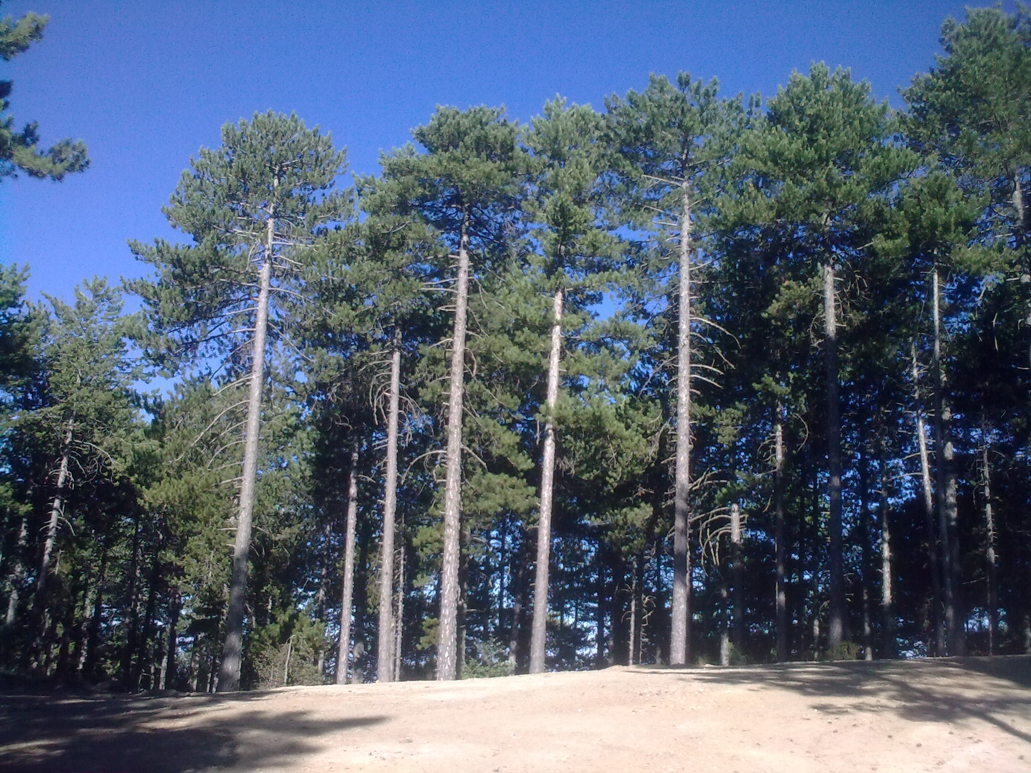
Black Pine along our path
Welcome to the inaugural activity of the 3rd season of The Cyprus Strollers. Our hike of Saturday 3 October 2015 takes place on the Troodos mountain range. We walk entirely along a dirt (forest) road, which winds west and then north on the principal Troodos massif, concluding at the picnic site of the attractive dam, near Prodromos village. Prodromos is the village with the highest altitude in Cyprus. The hike starts on the main road leading from Troodos square to Platres, involves several uphill and downhill sections, is 9 km long, rated 2+ (medium difficulty to difficult), and is expected to take about 3 hours. We walk at an altitude of 1400 – 1500 m. The hike starts at 10:45 am. Xenophon is leading this event, which will go ahead even in light rain; if you need to, call 97613720.
The hike is in dense forest, with the impressive black pine trees (Pinus nigra), golden oaks, common pines, cherry trees and several other species of trees and bushes delighting the Stroller. The path further offers a few enticing viewpoints, with views to Paphos forest and Prodromos village. We begin with a climb for the initial 10 min; we then go downhill for about 10 minutes; the next 20 min are fairly level; near the one hour mark there is a demanding uphill section for about 15 min; this is followed by a downhill section for some 20 min, up to about the 90 min mark; the rest of the path is mostly on a gentle uphill.
Because of the difficulty, we will only walk the trail in one direction. This translates to a set of logistics rules, which participating Strollers need to observe, as a group. Please study them carefully and make up your mind, based on your acceptance of these demands, as follows:
*you need to register for this activity (e-mail the walk leader by end Wednesday; no calls, please)
*the event is open only to Strollers who accept participation at the picnic or dinner, at the end of the hike
*we need to drive in cars of 2 adults (driver + one passenger); when registering, please indicate whether you are bringing your car, or if you need a lift
*to start, all cars shall drive from Nicosia to the walk finish (Prodromos dam); half of the cars will park there and the Strollers in those cars will get in the cars continuing from there
*half of the cars will drive on from Prodromos dam to the walk start on the Troodos – Platres road
*at the conclusion of the hike, all Strollers shall drive back from Prodromos dam to the Troodos – Platres road, to pick-up the cars parked at the walk start.
At that point, all cars shall drive to the picnic site or taverna.
Please read all driving instructions below and have a copy with you on the day. To turn this plan into a success, it is imperative that you adhere to times and use your odometer as instructed.
At the end of the walk we have the choice of holding a picnic at the designated picnic site near Prodromos dam, or driving a short distance to Louis taverna in Prodromos, for a served meal. Please indicate your preference when registering; we shall follow the preference of the majority of participants; an e-mail announcing the selection of picnic or taverna will reach participants on Friday. In case you register without indicating, it will count as a vote for the picnic. The picnic site is equipped with the usual facilities, but does not offer drinking water. This should not present any problem, since we can take the cars to the picnic site parking area.
If you live in or near Nicosia, you need to meet at the designated meeting point in Nicosia. If you are joining us from a distant place, kindly alert the walk leader as early as possible, to work out a plan for you and others traveling like you. The meeting point in Nicosia is the very large church named tis Theou Sophias (also referred to as Agia Sophia) in Strovolos, which offers ample parking space on its side street. The car trip starts at 9:00 am. Please ensure you observe start times, for the benefit of the group.
How to get to the walk finish (Prodromos dam), via Kakopetria village:
From Nicosia take the A9 motorway towards Troodos. The A9 smoothly becomes the B9 highway (towards Troodos), when the motorway ends (near Kokkinotrimithia). On the B9 you drive past the villages of Akaki, then Peristerona and then you reach the village of Astromeritis. At the Astromeritis traffic lights, where most cars turn left towards Troodos, turn left. Drive along the main road, until you reach Kakopetria. You do not need to enter Kakopetria, just drive along the principal road. As you pass Kakopetria, look out for the road sign on your left hand side, indicating a right turn, directing you to ‘Pedoulas, via Agios Nikolaos Stegis’. Turn right along this picturesque paved road, and drive its entire 12 km. This road ends at a T-junction, where it meets the Pedoulas – Prodromos road. Turn left at the T-junction, driving uphill towards Prodromos. You pass Louis taverna on your right. 200 m later you reach the only roundabout in Prodromos: take the main road continuing uphill, signposted to Troodos. In a few minutes you pass Prodromos dam, on your right. Continue to drive along the main road, past the dam, but slow down, looking out for a collection of signs; one wooden sign indicates ‘nature trail’, another wooden sign indicates ‘Stavroulia’ and has a map; a third, metal sign, carries illustrations of trees and an arrow. At this point, exit the paved road, turning right and park on the side; there are sufficient parking spaces. We meet here. The distance from Prodromos roundabout to the meeting point is 2 ½ km. Note: the route via Kakopetria village and Agios Nikolaos Stegis is the shortest of the two options available, from Nicosia, and the most picturesque.
How to get to the walk finish (Prodromos dam), via Troodos square:
From Nicosia take the A9 motorway towards Troodos. The A9 smoothly becomes the B9 highway (towards Troodos), when the motorway ends (near Kokkinotrimithia). On the B9 you drive past the villages of Akaki, then Peristerona and then you reach the village of Astromeritis. At the Astromeritis traffic lights, where most cars turn left towards Troodos, turn left. Drive along the main road, until you reach Troodos. From Troodos, follow the road signs towards the village of Prodromos. The distance from Troodos square to the meeting point is 5 ½ km. As you approach the 5 ½ km mark slow down, looking out for a collection of signs; one wooden sign indicates ‘nature trail’, another wooden sign indicates ‘Stavroulia’ and has a map; a third, metal sign, carries illustrations of trees and an arrow. At this point, exit the paved road, turning left and park on the side; there are sufficient parking spaces. We meet here. Caution: if you have reached the dam on your left, you have gone too far; turn back and drive uphill.
How to get from the walk finish (Prodromos dam), to the walk start on the Troodos – Platres road: Zero your odometer and drive uphill, in the direction of Troodos square. After 5 ½ km you have reached Troodos square; turn right, into the square, and drive along the cobbled road through the square; as you exit the square take the road to Platres; near the 9 km reading slow down and look out for a side road on your right. This is a dirt (forest) road going uphill, signposted to ‘Platanos Kalogirou 7 km’ and ‘Prodromos dam 10 km’. Park on the side. The walk starts here.
How to get from the walk start on the Troodos – Platres road to the walk finish (the picnic site behind Prodromos dam): Zero your odometer and drive uphill, in the direction of Troodos square. After 3.6 km you have reached Troodos square; turn left, into the square, and drive along the cobbled road through the square; as you exit the square, at the T-junction, take the road to the left towards Prodromos. Near the 9 km reading slow down and look out for the collection of signs. At this point turn left, into the dirt road, and drive some 300 m up to a junction, where you turn right, signposted to the picnic site; after another 300 m you reach the picnic site.
How to get to the meeting point for the car trip:
From Nicosia get to the junction between Cineplex and Apolloneion Hospital. At the traffic lights where you have the Cineplex on your left hand side and Apolloneion Hospital on your right hand side, zero your odometer and turn left. At the 0.3 km reading you see Lidl supermarket on your right. At the 0.8 km reading you reach traffic lights. Turn left into Elaionon street. Immediately after you observe the very large church of tis Theou Sophias, with its green dome, on your right. Just past the church (1.0 km reading) take the first turning to the right into Kastellas street. This side street offers ample parking space. Park here.
How to get to the walk start on the Troodos – Platres road:
Driving from Karvounas zero your odometer as you enter Troodos square (where you turn left, with the car park on your left). Drive towards Platres. At the 3.6 km reading you see a sign on your right at the start of a dirt road, indicating ‘Platanos Kalogirou 7 km’ and ‘Fraktis Prodromou 10 km’.
Google Maps: Here is a map taking you from the junction between Cineplex and Apolloneion Hospital to the church of tis Theou Sophias http://tiny-url.org/zu5ijAJn
Google Maps: Here is a map taking you from the Presidential Palace to the church of tis Theou Sophias: http://tiny-url.org/hEk7ggCF
Google Maps: Here is a map showing the walk start area https://www.google.com/maps/dir/34.9087223,32.8595522//@34.915004,32.8397682,15z
Google Maps: Here is a map showing the walk finish area
https://www.google.com/maps/dir/34.9475314,32.843931//@34.9442071,32.8372791,15z
Disclaimer: If you attend a Cyprus Strollers walk you do so entirely at your own risk. The Cyprus Strollers is a social club and neither the organizers nor the leader of the walk are responsible for the health and safety of those taking part.
